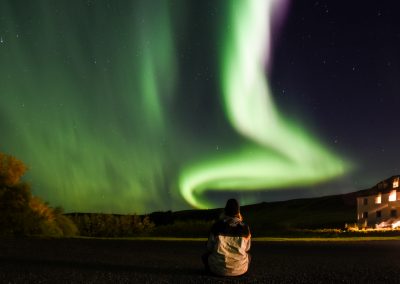
In the first week of October 2016, I went to Iceland for a week, as part of an AFS event, the Chapter Exchange, which brought together ten volunteers from each country – Germany, Slovakia, Iceland and Portugal – to discuss Europe’s multiculturalism, namely the inclusion of refugees in our societies. The week would be divided between accommodation in the countryside and accommodation in the city. For the first three days, we stayed at an old school in Thorlakshofn, relatively in the middle of nowhere, since we just had two or three neighboring houses in sight. In the last three days we continued the discussion in the capital Reykjavik. On the day we were going to move from the countryside to the city, Icelandic volunteers offered us a visit to the famous Golden Circle.
One of the most famous tours in Iceland is precisely the Golden Circle, listed as a mandatory tour on almost all Icelandic tourism agencies, mainly for its proximity to the capital. The Golden Circle (which is actually not a circle) consists of three equally impressive places, as spectacular as they are unique, in southwest Iceland: the Thingvellir National Park, the geothermal area of Geysir and the huge Gullfoss waterfall. Usually the visit is made in the order I enumerated, but as we did not come from Reykjavik, but that was our destination, we did the “circle” the other way around.
Unfortunately the day started badly! The bus that was going to transport us had a problem and arrived more than an hour and a half late and what was going to be a short visit, became even shorter. So, a lot of information that I transmit to you is based on Icelandic tourism sites, such as Guide to Iceland, as we only had from 30 to 45min in each place. As an introduction, some photographs of the Icelandic landscapes between the different stops, an important part of this tour!


.
THE WONDERFUL GULLFOSS
It is said to be one of the most spectacular waterfalls in Iceland – and the only one I have seen! It is less than 10 minutes away from Geysir, in fact we passed it before reaching the waterfall.
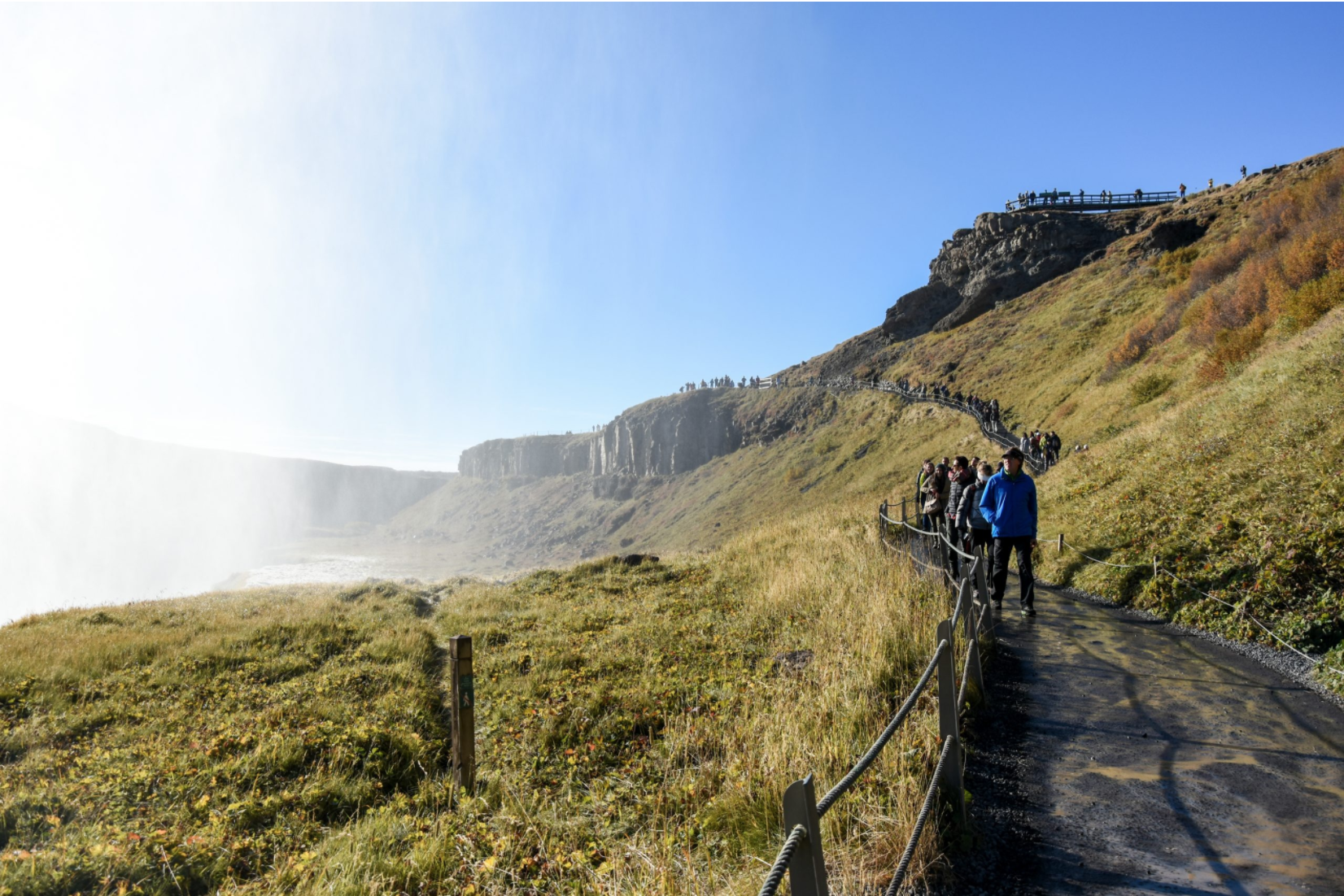
Located in an old valley, the Hvita River contains this powerful waterfall, divided into two falls, with a total height of 32m. Summer (also understood as late spring and early autumn) will be the best time to visit Gullfoss, when there is no ice on the ground, as it is possible to get very close to the waterfalls. Close or far for sure you’ll get a little wet, because the force of the water is so great, that it raises particles of water that wet even those who do not want to! This does not mean, however, that Gullfoss is less spectacular in winter – at least that’s what it is said, because I didn’t see it. Although you can’t get that close, seeing it partially frozen is fascinating. Keep in mind, however, that although the temperatures in Iceland do not reach very low values, the wind is the worst enemy, especially the one brought in from the neighboring glaciers, so get warm!
Unfortunately, this waterfall was once at risk of being transformed into a dam. In the early 20th century, foreign investors had the opportunity to transform it into a hydroelectric plant. The land owner, Tomas Tomasson, indirectly ceded the rights of the land but his daughter, Sigridur Tomasdottir, refused to let the natural wonder, which she loved so much, be destroyed. Since threatening to jump from the waterfalls or walking the 200km on foot several times from and to Reykjavik, her actions have caught the attention of national critics and ensured that the dam construction process was delayed. Eventually, the lawyer Sigridur hired, Sveinn Bjornsson, managed to get investors to cancel the contract. Later that same man was elected Iceland’s first president. Sigridur was immortalized in a stone sculpture at the top of the waterfall and is remembered as a poor and uneducated woman, fighting a capitalist and patriarchal society in the name of the beauty of nature; she helped pave the way for feminism and environmentalism, so typical of Icelandic culture!


.
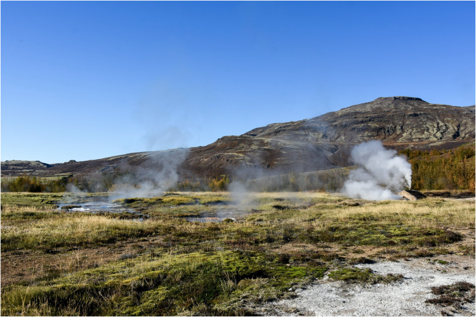
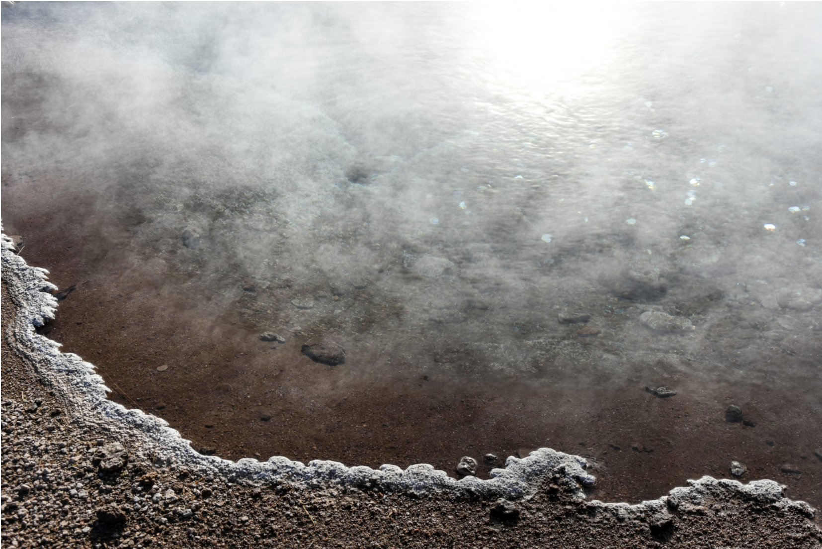
THE GEOTHERMAL AREA OF GEYSIR
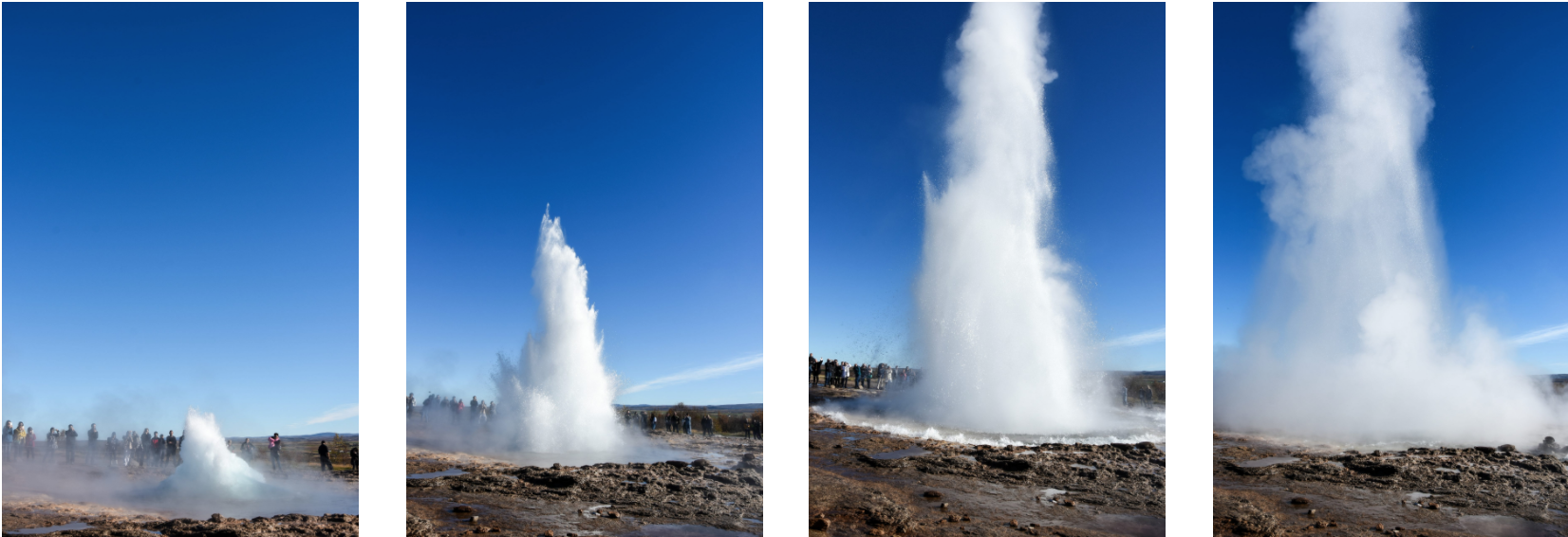
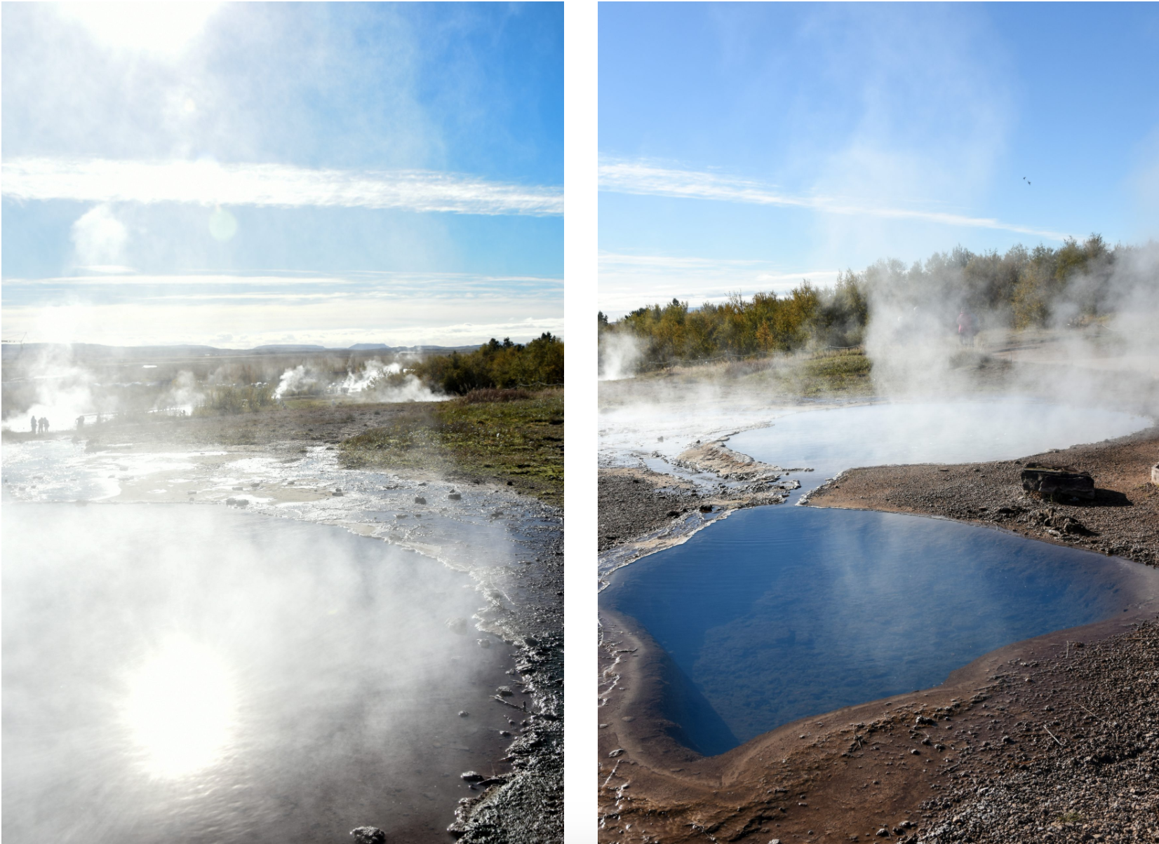
Our second stop at the Golden Circle was at Geysir, located in the Haukadalur valley, where geothermal activity is quite intense. The area contains many hot pools and fumaroles, an attraction that would be fascinating enough, even without the two geysirs that make it famous. The first one, which is less noticeable, is the one that gave name to all the others, the Great Geysir, the oldest documented in European literature. Its name comes from the ancient Nordic verb ‘to gush’, geysa, and it rarely erupts. Its neighbor, Strokkur, erupts every ten minutes or so, and the water can reach between 20 and 40 meters height.
It is possible, however, to explain why the original Geysir has so little activity. It will have to do with the tectonic activity of the area, as well as the intrusive human intervention. Studies show that it exists for 10,000 years and tends to erupt in cycles. It is usually triggered by a major earthquake but slowly, over time, it becomes inactive again. Even after being triggered, however, it is unpredictable in terms of time and consistency. Tired of the fact that one of the country’s most famous landmarks is so inconsistent, in 1935 Icelanders dug a canal around Geysir’s opening to lower the groundwater and encourage it to erupt. Although it worked for a short time, the channel was clogged and the activity stopped again. In 1981, this channel was cleared and it was found that Geysir could be forced to erupt by pumping soap, but there were many environmental implications, so the practice was stopped in the 1990s. Since then, Geysir is mostly inactive, although it erupts occasionally, without possible forecast, only for the lucky ones who were in the area at that time. When it erupts, it is much bigger than Strokkur and it has already reached a height of 170m!
But part of what makes the Golden Circle so incredible is the existence of a geysir, Strokkur, so active and reliable, in such an accessible location. It is not easy to gather the conditions for a geysir to exist. An intense heat source is required (for geysirs to erupt, magma is needed near the surface of the earth to heat the rocks enough to boil water), an underground water flow is required and a natural plumbing water system is required (there must be an underground reservoir for water to accumulate and an opening, lined with silica, so that water cannot escape from it, which rises from the reservoir to the earth’s surface).

.
THINGVELLIR NATIONAL PARK
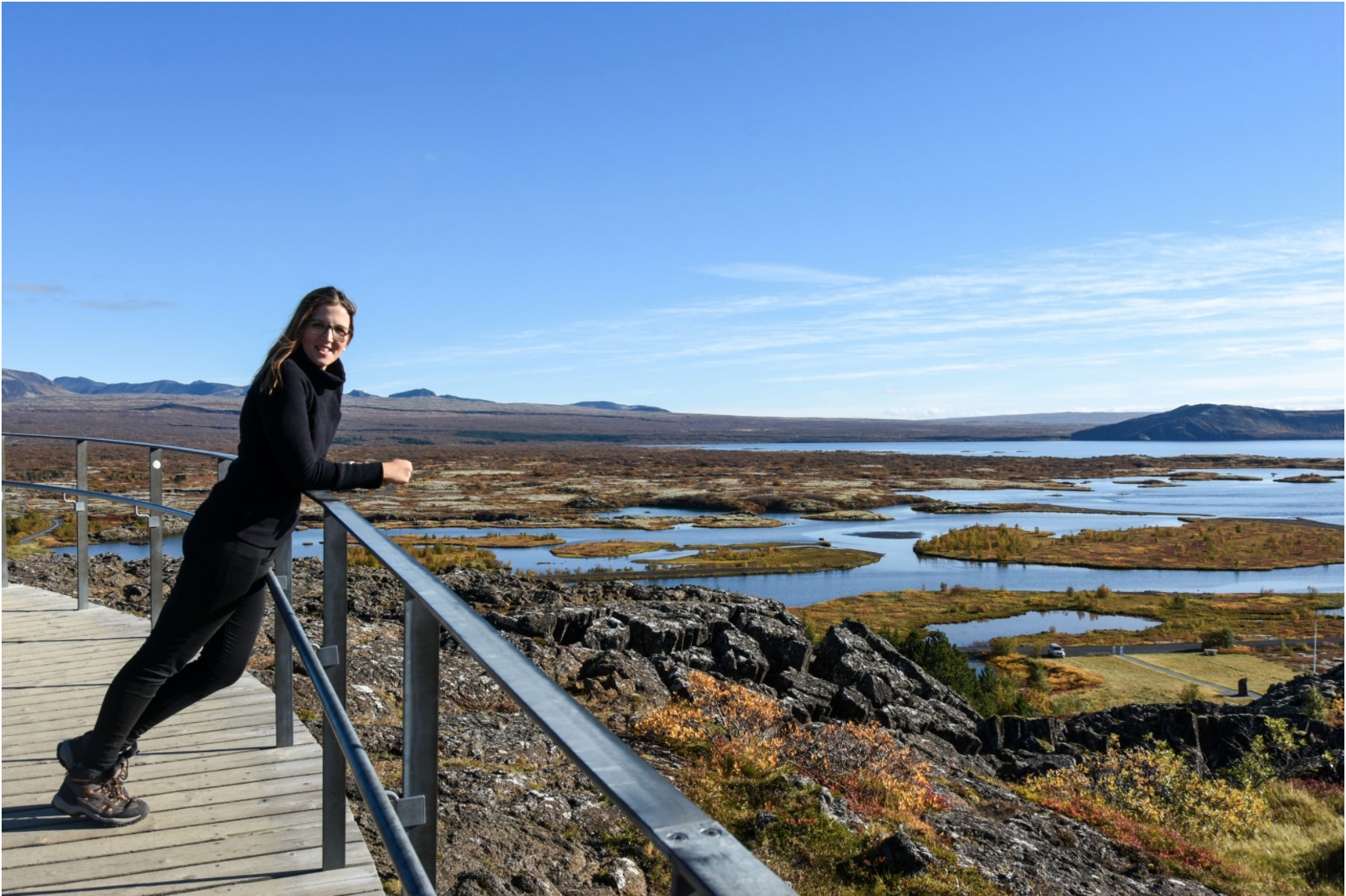
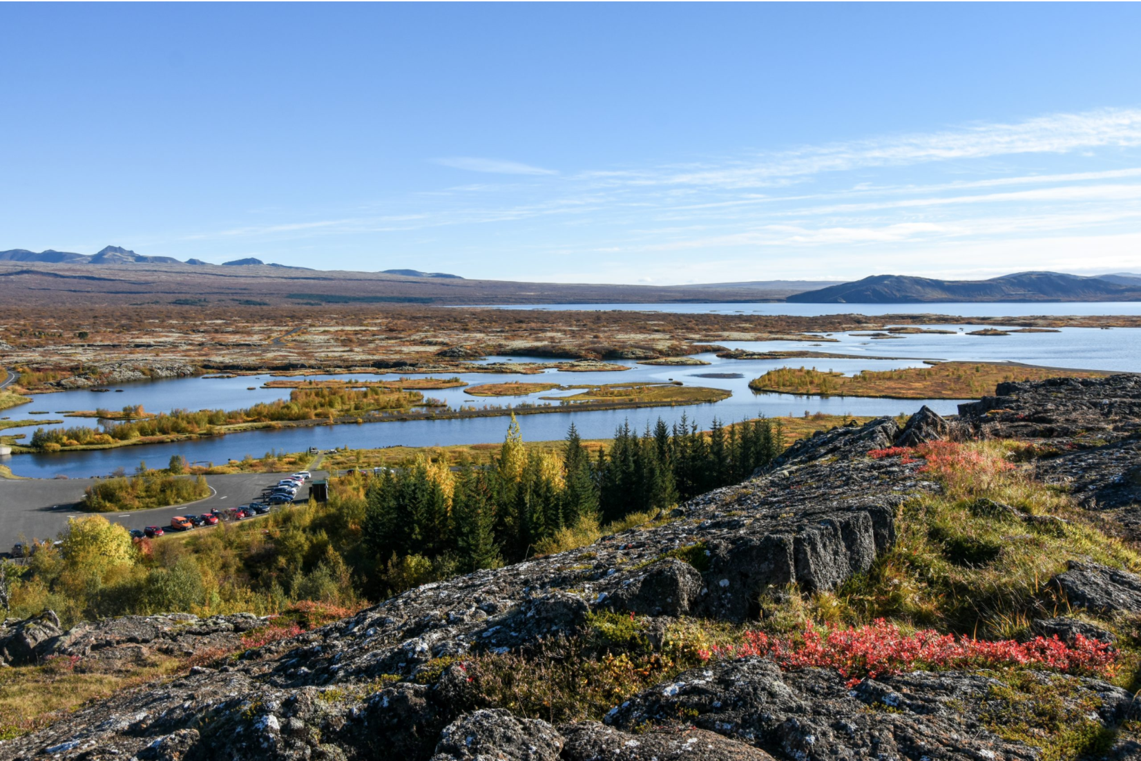
The third stop, Thingvellir National Park is an incredible place, full of history, surrounded by incredible geology and an UNESCO World Heritage Site. The park is a 50 minute drive from Geysir and another 45 minutes from Reykjavik and is usually the first stop of the Golden Circle, when you leave the capital. The roots of how this island was formed and how its civil society was created can be found here!
The park’s incredible geology comes from the fact that it is located directly between the North American and Eurasian tectonic plates, in the rift valley that crosses all of Iceland, the only country where this rift can be seen above sea level. When you enter the park you find a cliff that is, in fact, the corner of the North American plate. The other plate is a couple of kilometers away, on the opposite side of the park. It was a pocket of magma formed between the two plates that was responsible for the creation of Iceland millions of years ago. Each year the plates are moving about 2.5 cm apart, which is why Iceland has such high volcanic activity. Evidence of this process can be found throughout the park. The area consists of long stretches of lava rock that surround Thingvallavatn, the largest natural lake in the country. The fact that the park is so green is because there has been no eruption in the area in the last 2000 years, although there are regular earthquakes. The cracks opened by these earthquakes are filled with fresh water, which melts from the Langjökull glacier and travels underground, through the porous lava rock, towards the lake. This long filtration process causes the water to be free of sediments and, therefore, crystalline, with a visibility that exceeds 100 meters, which not only makes walking through the area much more scenic, but also creates the opportunity to go diving between the two tectonic plates! However, if you prefer to see “where the land splits” and at the same time remain completely dry, it is possible to walk through the Almannagja gorge. This stunning valley shows us how the area’s geological processes work and takes us to the Oxararfoss waterfall.
However, Thingvellir’s incredible location and fascinating geology have nothing to do with why the park is an UNESCO World Heritage Site. It has to do with the past. To know the history of Thingvellir is to know the history of the Icelandic people. The first permanent settlers in Iceland arrived in the 800s and were mostly Viking clans who refused to bend the knee to the new king of Norway. In 930, however, they decided that some kind of collective government could facilitate disputes on the island, and each of the thirty groups present sent someone to represent them. The place of the meeting was called “the fields of parliament”, which translates into Thingvellir. This first parliament was such a success that the tradition continued year after year, century after century. The institution remained even after Iceland was acquired by Norway in 1262 or transferred to the Danish crown in 1380. In 1844, after the only pause this parliament saw, it was transferred to Reykjavik, but its function remained the same. This story makes the Icelandic parliament the oldest representative parliament in the world. While the populations of Christian Europe faced feudalism without thinking of any democratic process, Iceland’s “pagans” created a representative system that would serve as a model for many to follow.
Even after the parliament’s location was moved to Reykjavik, the area remained of great emotional value to Icelanders. It was here that the country decided to declare and celebrate its independence from Denmark in 1944, after the Nazis invaded it and the Allies took control of the island, and it was also here that the election of the nation’s first president, Sveinn Bjornsson, was celebrated.
.


Being one of Iceland’s most popular tours, I found many different ways to visit the Golden Circle during my research. There are hundreds of different tours, from dozens of agencies, that combine the Golden Circle with extra activities or other touristic sites. I would say that the easiest and most common way is to rent a car and visit whatever you want, at the pace you want, without the schedules and itinerary restrictions that comply with a guided tour, and being able to continue visiting the rest of the island or other places nearby.
For those who prefer to avoid the pressure of driving in Iceland there are some very simple and efficient tours, such as visiting only the three attractions, like the one I did, and returning to Reykjavik. You can also join the visit to the Kerid crater and a dip in the Blue Lagoon. Or, why not, to add a snowmobile ride on the Langjökull glacier. It is also possible to combine the Golden Circle with lava caving on the Reykjanes Peninsula. Or buy at once the three-day tour along the South Coast, which in addition to the Golden Circle includes visits to numerous waterfalls, the Kerid crater, the famous black sand beach Reynisfjara, the Jokulsarlon Glacier Lagoon (also known as Diamond Beach) and to the Blue Ice Cave, for stunning photographs. Remember though that Iceland is not cheap and booking tour after tour will be more expensive than renting a car.
If you liked this post and want to read more about my trip to Iceland, you can visit the following posts: